
Guidelines for submitting articles to Mar Menor Golf Resort Today
Hello, and thank you for choosing Mar Menor Golf ResortToday.com to publicise your organisation’s info or event.
Mar Menor Golf Resort Today is a website set up by Murcia Today specifically for residents of the urbanisation in Southwest Murcia, providing news and information on what’s happening in the local area, which is the largest English-speaking expat area in the Region of Murcia.
When submitting text to be included on Mar Menor Golf Resort Today, please abide by the following guidelines so we can upload your article as swiftly as possible:
Send an email to editor@spaintodayonline.com or contact@murciatoday.com
Attach the information in a Word Document or Google Doc
Include all relevant points, including:
Who is the organisation running the event?
Where is it happening?
When?
How much does it cost?
Is it necessary to book beforehand, or can people just show up on the day?
…but try not to exceed 300 words
Also attach a photo to illustrate your article, no more than 100kb

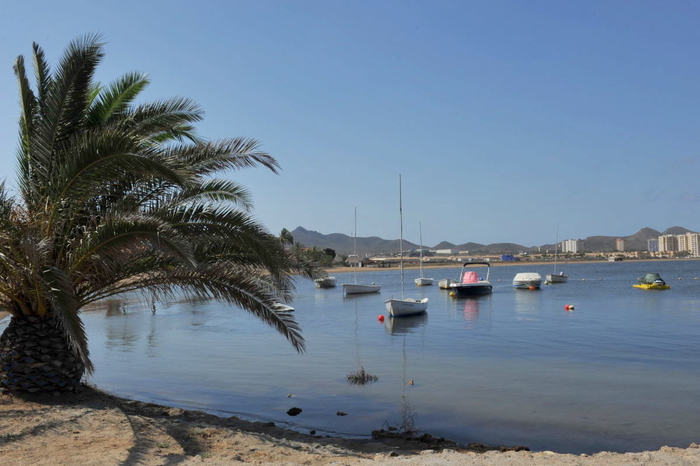
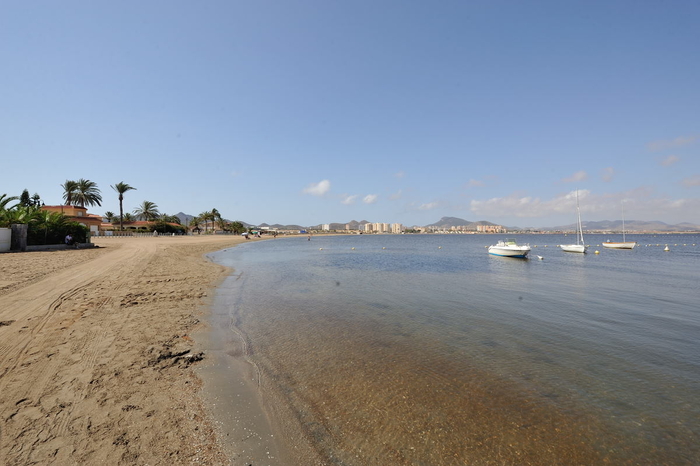
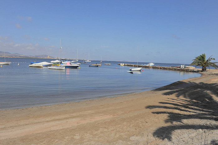
Cartagena beaches: Playa del Vivero
An attractive semi-urban sandy cove at the beginning of La Manga del Mar Menor
Playa del Vivero is a sandy little gem, tucked away just around the corner from the better known and infinitely more densely populated beaches of Playa Honda and Playa Paraiso.
Following the coastline around from these two larger neighbours on foot is easy, and indeed is well worth the effort, arriving at this picturesque little corner which was inhabited by local fishermen until just a few years ago.
Playa del Vivero is small at only 550 metres long, and only 15 metres wide, but is a pretty little curved bay, with a rocky outcrop on one corner, amplified for fishing boat use, which is still used to launch and moor small boats with a shallow draw.
There is parking in the residential streets behind the beach, which requires a little more effort than walking around the coast as it is necessary to drive out from Playa Paraiso and around the back of the Marchamalo salt flats in order to reach the beach.

There are no services on the beach, but walk just around the corner to Playa Alemanes and there is an excellent restaurant, plus bins, sunbed and sunshade hire available.
This beach is officially classed as a Mar Menor, La Manga del Mar Menor beach.
Basically, all of the beaches listed as Mar Menor beaches are inside the circle of the Mar Menor, which covers a surface area of nearly 170 square kilometres, with 70 kilometres of internal coastline, separated from the Mediterranean by a 22km long strip of land, La Manga del Mar Menor, which is connected to the Mediterranean via a canal channel, feeding the Mar Menor with natural saltwater.
It has shallow fringes, which slope gently, and is only 7 metres deep in the centre, so the water temperature is warmer than that of the Mediterranean, particularly around the edges where it is possible to wade out 50 metres from the shore and still only be waist deep.
There is often confusion when talking about beaches on La Manga del Mar Menor, as there are both Mar Menor beaches and Mediterranean coastal beaches on this thin strip of land, one type of beach along each side, and to make matters worse, these are divided between two different local councils, those of San Javier and Cartagena. The divide between the two is brutal; straight across the middle of "the strip" as it is often called by foreign holidaymakers, the top part belonging to San Javier and the bottom part to Cartagena.

This beach is right at the bottom end of La Manga, where it joins with the rest of the Cartagena municipality, and hardly feels as though it has anything to do with La Manga del Mar Menor, but is classified as a La Manga del Mar Menor beach.
It is important when selecting a beach to understand that the Mar Menor beaches offer shallow and calm bathing conditions, whereas the Mediterranean beaches are wider, longer, windier, and are susceptible to wave conditions and currents.
The location of La Manga del Mar Menor beaches is generally defined by kilometre reference. Kilometre 0 is the tourist information point at Cabo de Palos and km 18 is the far end of La Manga by the Esculls de la Llana y Encañizadas, which is where dry land runs out! The remainder of "the strip" is marsh, and inaccessible, before it finally meets the salinas of the San Pedro del Pinatar municipality.
So this beach is pretty much at km 0!

Safety precautions for bathers
This is a Mar Menor beach and it is advisable to observe the following safety precautions when bathing:
Most of the Mar Menor beaches have very gently sloping shelves, meaning that bathers can walk a considerable distance from the shore and still only be waist high in the water. These shore fringes are also very warm, heating up more than the deeper waters, or the Mediterranean coastline, particularly during the hot summer months.
Many beaches are also protected by netting to exclude jellyfish.
This creates safe bathing areas for families but also leads to a situation which can be life threatening, as the safety of the beaches results in many elderly bathers bathing alone.This in itself is not life threatening, but every year there are unnecessary deaths when bathers suffer a heart attack, stroke, faint or have a dizzy spell of some sort whilst bathing alone, slipping into the water without anybody else being aware that this has happened.
The transition from hot beach to cold water can shock the body, causing dizziness or fainting, so it is advisable to splash the body with water to cool down before wading out into the Mar Menor or Mediterranean.
Even though there are lifeguards, accidents happen and every year there are unnecessary fatalities, the simple rule being if you have a medical condition, are taking medication, or are of advanced age, don´t bathe alone, no matter how shallow and calm the water is.
And for all ages, a red flag means do not bathe, particularly on the Mediterranean beaches.
Click for introduction to the Cartagena beaches.
Click for more information about the municipality of Cartagena.
Other Cartagena Beaches


