
Guidelines for submitting articles to Mar Menor Golf Resort Today
Hello, and thank you for choosing Mar Menor Golf ResortToday.com to publicise your organisation’s info or event.
Mar Menor Golf Resort Today is a website set up by Murcia Today specifically for residents of the urbanisation in Southwest Murcia, providing news and information on what’s happening in the local area, which is the largest English-speaking expat area in the Region of Murcia.
When submitting text to be included on Mar Menor Golf Resort Today, please abide by the following guidelines so we can upload your article as swiftly as possible:
Send an email to editor@spaintodayonline.com or contact@murciatoday.com
Attach the information in a Word Document or Google Doc
Include all relevant points, including:
Who is the organisation running the event?
Where is it happening?
When?
How much does it cost?
Is it necessary to book beforehand, or can people just show up on the day?
…but try not to exceed 300 words
Also attach a photo to illustrate your article, no more than 100kb

Walking Routes Cieza, the PR MU-11, to Medina Siyasa
Sendero PR-MU 11: Medina Siyâsa (Route PR-MU 11)
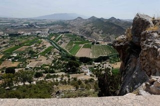
See Wikilocks map: Click here
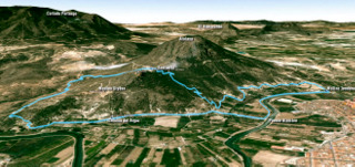
The PR-MU 11, Medina Siyâsa, is an 8.5km long walking route in the municipality of Cieza, a signposted circular walk which runs alongside the Vega del Segura river close to the town, and passes through the traditional fruit orchards which have been cultivated for centuries, up to the important Islamic archeological site of Medina Siyâsa and back again.
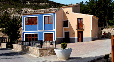
The route starts at the Molino de Teodoro (Teodoro windmill), which is located on the right hand bank of the río Segura (Segura river) and is easy identified by its blue painted exterior. This windmill can be visited by groups by prior arrangement, and is filled with historical equipment used in the mill when it was operational.
There is a car park next to the windmill in which vehicles can be left.
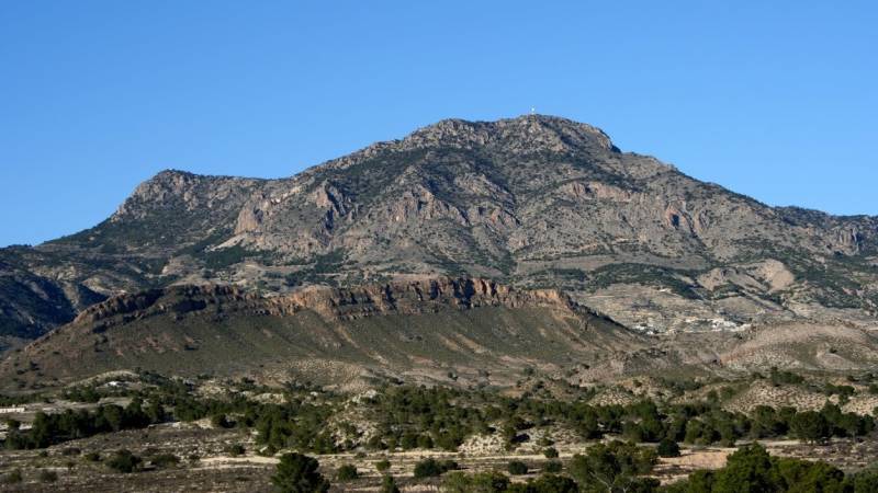
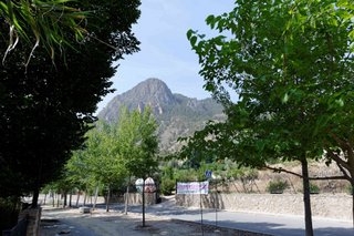
The riverside walk starts from the windmill, following the course of the river, as it wends its way around the foot of the historic urban landscape and old quarters of the town, whilst to the right the impressive peak of the Atalaya rock formation dominates the landscape.
On this first sector of the route, many different species of trees line the riverbank and abundant reed beds and marshplants can be seen.
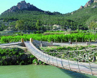
The walk passes the Puente de Alambre (Alambre bridge) and although the route does not cross the bridge it is worth going onto it and having a look at the river below and meadows which spread out either side.
The route then follows the path on the right before sloping down considerably towards the faldas de la Atalaya (Atalaya slopes). Next, the route crosses the Andelma irrigation channel and passes an ancient pine tree, before turning left into the Argaz area.
 A short distance after passing the “Chinica del Argaz”, the walk circles an imposing rock which has tumbled down from the Cerro del Castillo hillside above and then crosses the irrigation channel before starting to climb the “senda del Moro”, a narrow walkway with numerous bends which brings the walker to the top of the hill. Half way along the climb, the route takes a steep signposted path which leads to the south face of the Atalaya. This path that is known as the “Sarraceno” and is the most uneven section of the route, but it is only a short distance until the path becomes smooth again.
The next spot is breathtaking. The majestic peak of the Atalaya, the Islamic Castle which tops the peak can be admired from here, as well as the spectacular view of Valle de Ricote (Ricote valley). At this point, there is a narrow track which leads around the base of the peak to the archaeological site, and although this is not part of the route it is well worth the detour to see the Islamic archaeological settlement from close up.
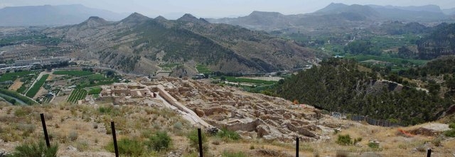
The site can only be accessed via a guide, but the path to it passes through an area which would once have also been covered by homes and businesses, as only a small fraction of the site has ever been excavated. From the pathway right up to the castle, this hillside was once covered with buildings. Down below are the remains of a fortified wall, the size of this site deceptive. Allow an extra half an hour to walk around to Medina Siyasa and back.
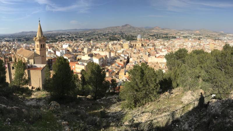
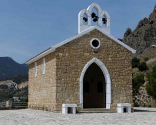
Walkers then return to the car parks close to the Santuario de la Virgen del Buen Suceso (Sanctuary of the Virgin del Buen Suceso) where tables and benches are available for those who wish to rest and enjoy the magnificent panoramic view of Cieza from the lookout at the chapel of Cieza´s patriot Saint.
Right at the side of the stairs up to the sanctuary the route resumes, following the “Zig-Zag” track descending the hillside and arriving back to the route that lead to Argaz. This time the route goes left, and borders the foothills of the Atalaya amongst soaring eucalyptus trees which mark the route. The route then follows the well known “cuesta de las cabras” and then right to cross once again the irrigation channel of Andelma and arrive back at the Molino de Teodoro where the walk concludes.
After this, there are several good restaurants offering excellent and well priced lunches to choose from.
This is a lovely walk to follow during the period of La Floración, when the 5000 hectares of peach trees which surround Cieza are in bloom. ( see Floración )
Visits to Medina Siyâsa and to the Molino de Teodoro need to be booked in advance through the Oficina de Turismo (Tourist Office).
Points of interest:
Molino de Teodoro
An ancient flour mill dating back to around the XVI century which has been totally restored and converted into a museum showing the traditional method of grinding wheat to produce flour.
Click Molino de Teodoro
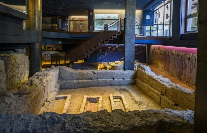
The Islamic archaeological site of Medina Siyâsa
Archaeological site dated back to the Islamic period (XI-XII century). The town was abandoned following the Christian Reconquist of the area in 1243, hence its excellent condition.
Click Medina Siyâsa
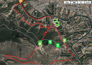
Details about the route:
Access to the route: Puente de Hierro (Iron bridge) / Right bank of the river.
Start and finish point: Molino de Teodoro
Coordinates: East 637926, North 4232579
Total Distance: 8.50 Km. Estimated time: 2.15 hours. ( Allow a good three hours if planning to also visit Medina Siyâsa)
Asphalted or cement part of the route: 2.00 Km.
Rural or forested part of the route: 4.40 Km.
Minimum Altitude: 170 m. Maximum Altitude: 349 m. Absolute climb: 180 m.
Level of difficulty: Medium
(Well walked paths and tracks that climb and descend)
Click for map, Molino de Teodoro, Cieza
Click for further information about visiting Cieza. This includes accommodation options, places to visit and general information about the area: Click Cieza section
Share your pictures with us via our what's on facebook if you do go and enjoy yourself!
Join the Murcia What's On and Where to Go group on Facebook to keep up to date with all the latest events taking place near you: https://www.facebook.com/groups/MurciaWhatsOnAndWhereToGo/


